Now that the logistics are in place and I know what cities I will visit, it’s time to start looking at what I want to see in those cities. There are a lot of services out there that will help you find the right tour. Some of it is built into travel apps like Expedia & Travelocity, which can give you some discounts with their point systems. There are many more apps out there that are strictly tour only, like Viator or the Tour Guide.
I have compared many of the apps, and they are similar to each other in price and options. So, for this next adventure, I have chosen to use Viator as my primary tour provider based on a couple of friends’ recommendations.
I won’t get into which tours I’ve picked for this coming trek across Europe because those will come in later blogs.
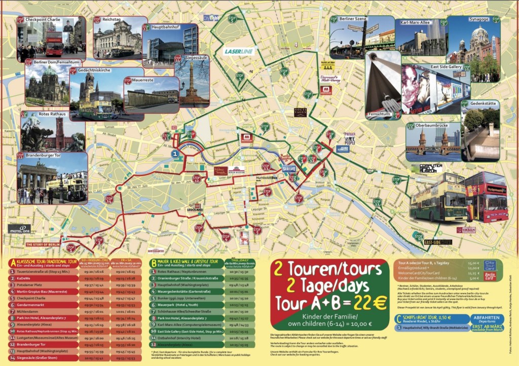
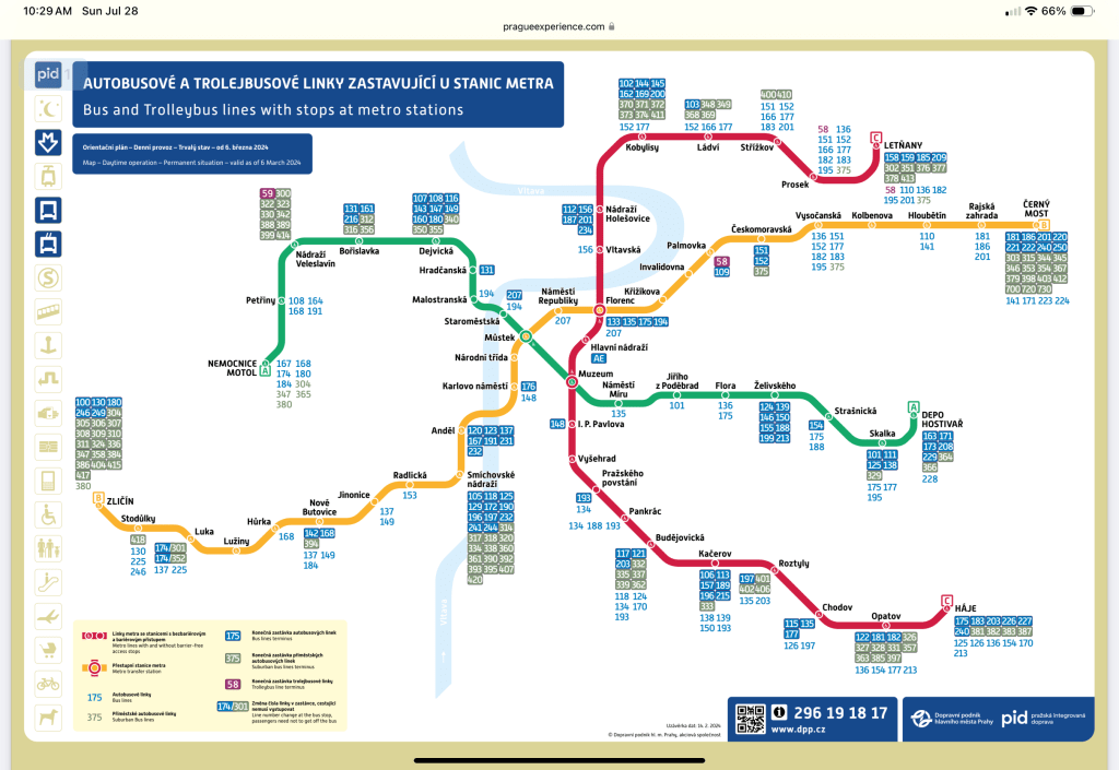
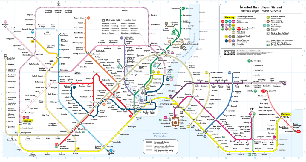
The other part of finding the right tours is determining how you will get to those tours you’ve booked. One of the things I like to do is find a place to lay my head near the action so that I can walk to as many attractions as possible. But sometimes that is not possible, so make the most of it; I’ve been researching each major city’s public transportation systems to see how to use them in case there’s an app or if there’s some sort of tourist card you can get that lets you take unlimited rides.
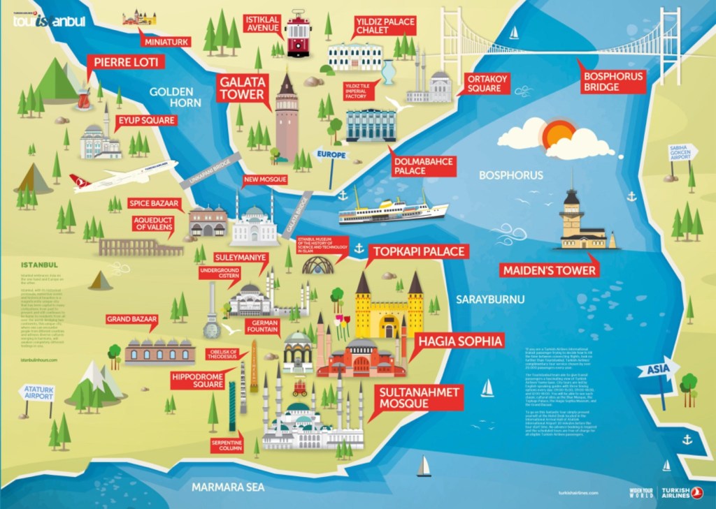
At the same time, Google Maps is an excellent resource for navigating cities and finding directions. I find that downloading a city’s tourist map as a PNG file on my phone is a great way to have access to where all the attractions are. So, I found that some city maps are nicer than others.